Fake and misleading bushfire images circulate on social media

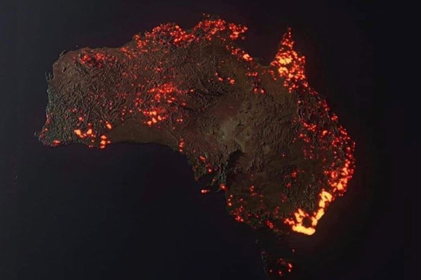
Image: Anthony Hearsey/Artist’s interpretation of fires detected in Australia over one month
A “huge amount” of misinformation surrounding the recent bushfires in Australia has begun circulating online.
There are concerns a number of fake and misleading images depicting the fire crisis are being shared widely on social media.
One map of Australia (featured above), shows an artist’s visualisation of all the places fire was detected over one month.
But many of those sharing it are claiming it’s a live map of the bushfires currently burning across the country.
Another map, taken from the MyFireWatch website, is also being circulated as a representation of all current bushfires.
Here is a map of all the fires burning in Australia.
Here also is a map of Australia overlaid on Europe. #Bushfires #AustraliaFires #vicfires #nswbushfire #NSWfires pic.twitter.com/x35u7etnuB— Martin (@marty386) December 30, 2019
But the data used to create the map actually incorporates “any heat source that is hotter than its surroundings”, including gas flares or reflective industrial roofs.
Australian editor of Storyful Stephanie Hunt tells Luke Grant there’s a “huge amount” of misinformation circulating about the Australian bushfires.
“It’s across all the different social media platforms.
“The golden rule, really, is to work hard to check your source… just don’t take a post at face value.”
Click PLAY below to hear the full interview


